You are here
Back to topLondon: A History in Maps (Hardcover)
$45.00
Usually Ships in 1-5 Days
Description
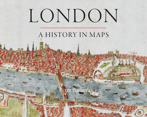
Over the past 2000 years, London has developed from a small town, fitting snugly within its walls, into one of the world's largest and most dynamic cities. London: A History in Maps illustrates and helps to explain the transformation using over 400 examples of maps. Side-by-side with the great, semi-official, but sanitized images of the whole city, there are the more utilitarian maps and plans of the parts—actual and envisaged—which perhaps present more than topographical records. They all have something unique to say about the time when they were created. Peter Barber's book reveals the "inside story" behind one of the world's greatest cities.
About the Author
Peter Barber is Head of Map Collections at the British Library. His many books include The Map Book and (with Tom Harper) Magnificent Maps: Power, Propaganda and Art.
Praise For…
“[E]ndlessly absorbing. . . . [A] skillful balance between the city’s shape-shifting actuality and the various fantasies, cherished by everybody from Christopher Wren to the Luftwaffe, of what the place, with a few crucial tweaks, might become.”
— Times Literary Supplement
“With each page, we witness London’s horizontal and vertical expansion. The collected work of London’s cartographers shows urban mass as a living entity, pushing forever outward. In its entirety, Mr. Barber’s book captures this energy and sense of organic growth. . . . This is a coffee table book that deserves to be read and studied. . . . [A] beautiful and engaging book.”
— Darren Richard Carlaw
“Highly recommended.”
— W. S. Rodner, Tidewater Community College
“Creatively designed and copiously illustrated, this beautiful and informative coffee table publication replicates an exhibition that was displayed at the British Library from November 2006 to March 2007. . . . This handsome publication will be a delightful and useful resource for a variety of audiences, including the general public; map collectors and bibliophiles; local and urban historians; and scholars interested in historical geography, urban geography and planning, and the history of cartography.”
— Ronald E. Grim, Boston Public Library
"The entire volume exceeds the author’s expressed aspirations to present an honest and inclusive representation of London. I particularly appreciated the author’s perspectives on the history of mapping, which includes analysis and documentation of the highly selective nature of maps and mapping throughout history. The analysis of the motives of cartographers and publishers in particular is outstanding, being something few other books of this type include and a worthwhile addition to any publication discussing the history of cartography."
— Patti Day, University of Wisconsin–Milwaukee